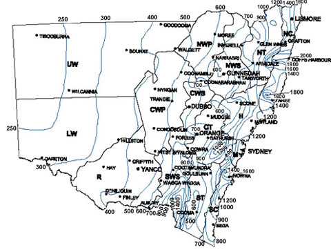
Isohyets are lines on a map that show amounts of rainfall. This maps isohyets show average annual rainfall for stations with more than 20 years of records in Sydney. This map shows a higher amount of rainfall in the eastern portion of the map, with the absolute most rainfall occurring on the coast.
No comments:
Post a Comment